| Filed in Blog, Hiking & Backpacking, Utah | Disclaimer: I use affiliate links and may receive a small commission on purchases. | Leave a Comment
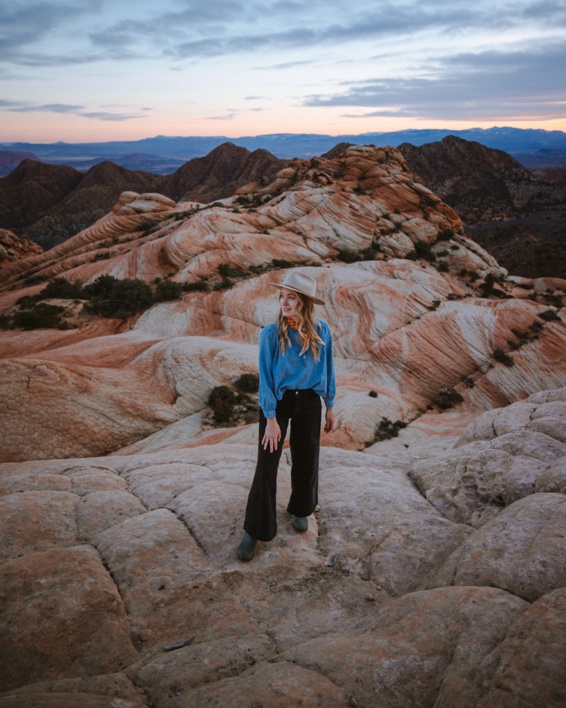
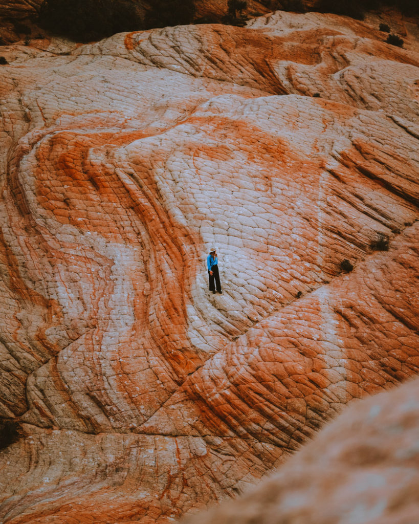
Utah seems to have an endless variety of unique landscapes, and I find myself returning over and over to explore more. Southern Utah road trips have been some of my favorite memories outdoors and it’s because of incredible experiences like hiking Yant Flat, also known as the Candy Cliffs. Swirls of orange and white sandstone makes it apparent why it was named ‘Candy Cliffs’.
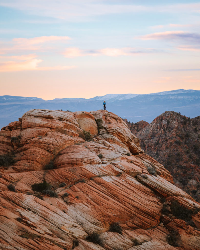
Yant Flat is a relatively short hike with high reward and definitely a lesser known area than the popular Utah National Parks nearby like Zion National Park. We had this view to ourselves for sunset and I’m going to share everything you need to know to have a magical experience here at Yant Flat Trail.

- Quick Overview of Yant Flat Candy Cliffs Hike
- Where is Yant Flats Trail?
- Yant Flat Candy Cliff Directions
- Yant Flat Road Conditions
- Yant Flat Trailhead Report
- Candy Cliffs Trail Report
- Best Time to Visit the Candy Cliffs
- Where to Stay when Visiting Yant Flat:
- Nearby Destinations:
- Watch my Utah Youtube Video!
- Conclusion: Yant Flat Candy Cliffs Trail
Land Acknowledgement: Nuwuvi (Southern Paiute) and Pueblos Land. Find what Native Land you are visiting by using the app Native Land! I encourage you to read the history and culture of the Indigenous people who’s land you are visiting! And consider visiting nearby cultural centers and seeking out other ways to financially support Indigenous People.
Photos in Collaboration with Emilie Hofferber, Marylee Burman and Logan Reavis.
Quick Overview of Yant Flat Candy Cliffs Hike
Yant Flat Trail Details:
- 3.4 miles round trip (longer if you decide to explore the area)
- 337 ft elevation gain to main view point
- Full Sun
- No amenities at trailhead (water, bathrooms)
- No permits, passes or cost required
- Camping Nearby
- Dogs Allowed
Where is Yant Flats Trail?
Yant Flat Trail is sandwiched between the Red Cliffs Recreation Area and Pine Valley Mountain Wilderness in Southern Utah. The trailhead is about a one hour drive from St. George which was our adventure base. Leeds Utah is the closest city before heading out of cell service into Dixie National Forest. I recommend making sure you are stocked with fuel, water, and food before heading out! Also, downloading an offline version of google maps is very helpful!
Nearest Airports:
Las Vegas International Airport: 3 hour drive
St. George Regional Airport: 1 hour drive
Yant Flat Candy Cliff Directions
I always recommend downloading AllTrails maps of a trail and using the directions from there as well.
GPS Coordinates to Trailhead: 37.234790, -113.477050
From St. George, take I-15 North to Leeds, Utah. Take Silver Reef Road (which becomes N Oak Grove Dr) to Danish Ranch Road. Google will take you to Yant Flats Trailhead / Anna’s Viewpoint Trail. There are no signs to mark the parking. And it could easily be missed!
The parking area is two small dirt lots with little trails going in every direction. Park here and load up your downloaded AllTrails trail map to navigate through the mess of trails! You’ll eventually end up on a very distinct, worn in trail. And the terrain changes from sand to rocks and back to sand in some sections!
Yant Flat Road Conditions
I recommend having a vehicle with at least some clearance, like that of a standard SUV. You can probably make it there in a typical sedan, but it would be a bit technical and conditions would have to be just right! Large amounts of rain can turn these dirt roads to mud and create conditions where you could get stuck. All Wheel Drive or Four Wheel Drive definitely doesn’t hurt either!
The road becomes a dirt road pretty quickly after turning onto it. Prepare for a rather bumpy and slow ride, and if you aren’t a fan of heights, theres a short section that might be difficult. Towards the trailhead you’ll be driving downhill along a steep cliff edge with no guard rails. But I’ve definitely seen way worse and it is a relatively short section!
You’ll pass Yankee Doodle Canyon just before the trailhead!
Again, for safety, I want to point out that we did not have cell service on this road. I always make sure to bring my Garmin GPS that has an SOS feature. And be prepared for the possibility of a flat tire.

Yant Flat Trailhead Report
I visited this area on a Thursday in March for Sunset, and we were the only group there. Because of the road in being a little rough, you’re going to see very few people out here during the week. The parking area is definitely small, but you shouldn’t have a problem getting a spot here.
There are NO amenities at the trailhead, so come prepared. I bring a Kula Cloth, which is an antimicrobial pee cloth to wipe with. This way I don’t leave toilet paper in nature. Come prepared with extra food, water and sun protection (hat, sunscreen, layers)!
Candy Cliffs Trail Report
As I mentioned, the trail is kind of confusing at the start. There are no signs and a bunch of small random trails from the parking lot. AllTrails downloaded maps really saved us a lot of time and also saved us from getting lost. The trail alternates between sandy and rocky. I recommend wearing shoes with decent traction!
Luckily there is not much uphill trekking on this trail, but the sandy conditions makes it feel moderately challenging and tiring. But the rewarding of sweeping views is worth it, I promise.
You’ll reach a section that descends to a stunning sweeping view of the marbled orange and white sandstone. It was caused from volcanic rock being pushed up and eroded over time and it phenomenal to see.
We scaled down the canyon to climb up and around on the cliffs. And if you’re able to, I highly recommend it for the views! This will add on some mileage to the original 3.4 miles, and coming back up the canyon can be challenging. AllTrails has a map that shows a loop that continues on called Yellow Top Loop as well that you can check out.
As always, Leave No Trace! Pack out all trash, food scraps, toilet paper, etc! And stay on the trail when going through vegetation!
Best Time to Visit the Candy Cliffs
When I visited in March, the weather was really moderate. It was sunny and warm during the day and cooled down at night. We needed a lot of layers for the changing weather. The ideal times to visit this area are Spring, Fall and Winter.
- Average Winter Temperatures: 50°/30°F
- Spring Temperatures: 70°/40°F
- Summer Temperatures: 95°/60°F
- Fall Temperatures: 75°/45°F
Summers can be REALLY hot here. I recommend hiking in the early morning or evening if hiking in the Summer to avoid the heat of the day.

Where to Stay when Visiting Yant Flat:
There is some dispersed camping nearby and if you are not familiar with finding free or dispersed camping, check out my Guide on Finding Free Camping!
Because we went in March, the nights were a bit chilly and we opted to stay in St. George about an hour away.
If you’re wanting a comfortable getaway stay, Check out Inn on the Cliff!

Food and Drink Recommendations:
- Station 2 By Zion Brewery: This brewery has a cat that is adorable! A great place to relax with a beer.
- George’s Corner Restaurant: we went back here after our first experience was so great! They have good variety, indoor and outdoor seating and great drinks.
- Banana Blossom Thai: We were tired after a full day of adventures and ordered to-go food from here. It was delicious with big portions of food.
Nearby Destinations:
Be sure to check out my other Utah Guides!
Near St. George Utah:
Other Utah Guides:
Watch my Utah Youtube Video!
Conclusion: Yant Flat Candy Cliffs Trail
As you can see, hiking to Yant Flat is quite the adventure! This moderate hike opens up to incredible vistas of red cliffs and marbled orange and white desert textures. The candy cliffs are definitely worth the extra effort to get to. The long bumpy dirt road keeps traffic down significantly and allows for a more private experience here without the crowds!
Let me know if this is on your Utah adventure list now!!
Share and Save for Later!



Great tips, love the photos!